
Decatur
Island
A private, boat-access island with no public moorage and three distinct anchoring groups—each shaped by private tidelands, working waterfront, or limited shore access.
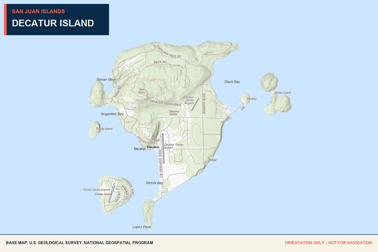
Southwest Cove
None
No public moorage is available.
Small boats
A small boat may be able to anchor in the cove at the southwest tip.
48° 29.11′ N
122° 49.43′ W.
None
All tidelands are private; anchoring does not grant shore access.
Water access only.
This is a limited small-boat anchoring option, not a public landing. Respect private tidelands and remain off the shore unless you have explicit permission.
Reeds Bay
None
No public mooring is documented.
North of cable area
The preferred anchoring area is reported north of the cable area.
48° 29.81′ N
122° 49.59′ W.
None
Floats and piers in Reeds Bay are private.
Active shipyard
Read Brothers Shipyard operates in the bay, with several piers extending into deep water.
None
No public provisions are available.
None
No public fuel or pumpout is documented.
Not public
Do not assume the working shipyard provides transient service.
Cables. Piers. Private shore.
Keep clear of the cable area, shipyard activity, piers, and private floats. There is no public shore access from the bay.
Other Anchorages
East-side option
A possible anchoring location near the island’s public boat ramp.
Possible anchorage
Evaluate current conditions and private-property boundaries before using.
Muddy bottom
The muddy bottom is reported as favorable for anchoring.
Possible anchorage
Confirm depths, exposure, and shore restrictions before arrival.
Not one uniform harbor.
These locations are grouped for planning convenience, but they do not share identical protection, depths, holding, or shore access. Assess each separately using current official navigation information.
Private island.
Limited public access.
Decatur Island covers approximately 3.524 square miles and is accessible by private boat or water taxi. There is no Washington State Ferry service, and the private airport is reserved for Decatur Shores residents.
There is no town, public store, public moorage, or visitor accommodation. Boaters should distinguish carefully between the public ramp, preservation land, working waterfront, and private shorelines.
Davis Bay ramp
One public boat ramp is located in Davis Bay on the east side of the island.
Southern day use
The San Juan Preservation Trust allows public day use of its property at the southern tip. Follow posted boundaries and access rules.
Provisions + lodging
None. Arrive self-sufficient and do not assume public access beyond specifically designated areas.
A naval name.
An industrial trace.
The Wilkes Expedition named Decatur Island in 1841 for naval officer Stephen Decatur. On the south side, a concrete structure remains from an old kelp-processing plant that extracted potash for explosives.
Pending
Help us verify
Decatur Island.
We do not yet have a dated Baller Verified visit for these Decatur Island anchoring zones. Current observations about holding, depths, cable markings, shipyard traffic, public-ramp access, wakes, and private-property boundaries would help complete this guide.
Send local intel →Conditions change. Always rely on current official information for navigation and trip decisions.