
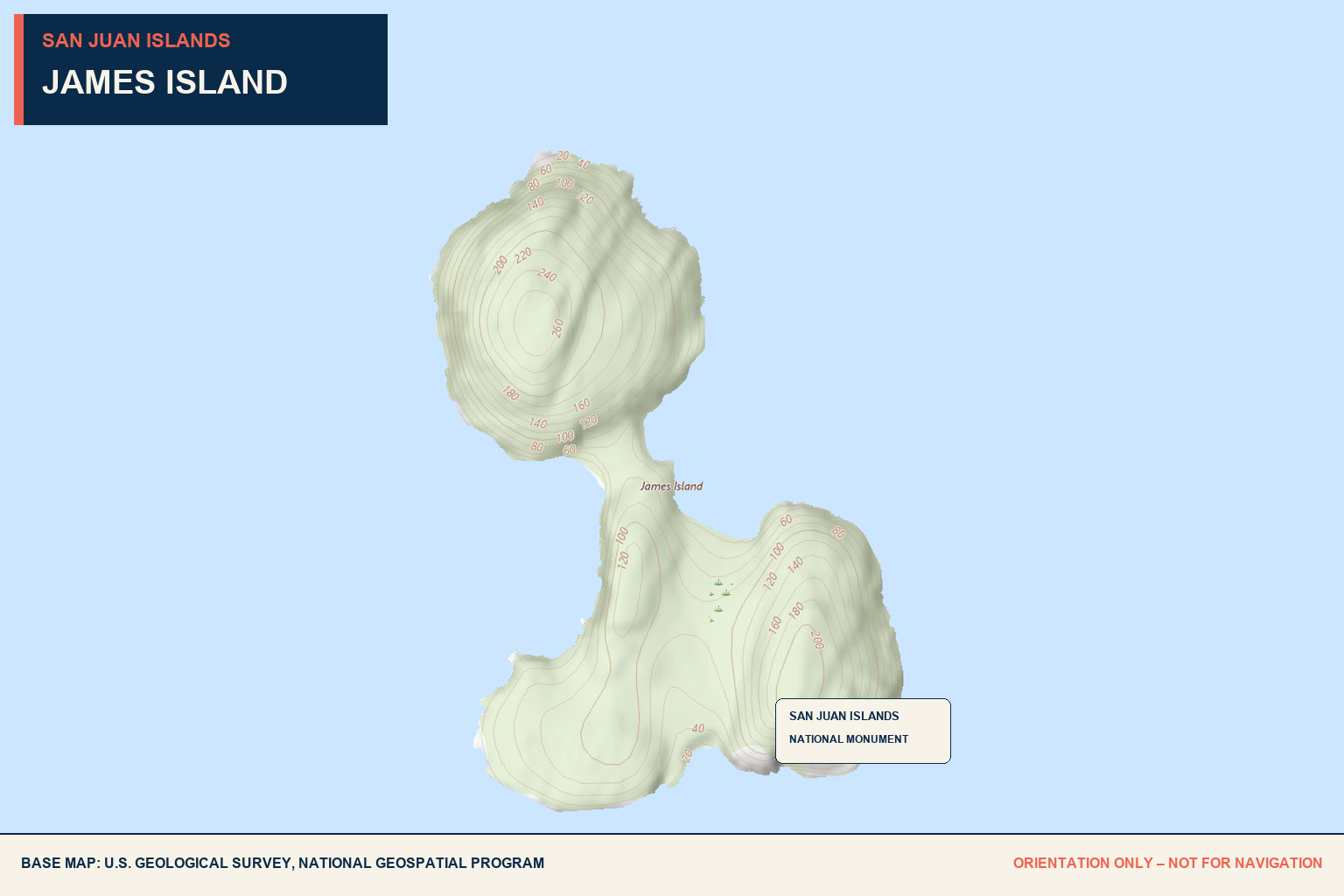
James
Island
A 581-acre marine camping park beside Decatur Island, with two exposed coves, year-round moorage, bluff trails, and dramatic Rosario Strait views.
East Cove
4 year-round
Four mooring buoys remain in place throughout the year.
Northern pair deeper
The two northern buoys sit in water reported eight to ten feet deeper than the southern pair.
East of buoys
Anchoring is possible east of the buoy field but remains exposed to Rosario Strait current and weather.
2 gravel beaches
Approach shore using either of the two designated gravel beaches.
Wakes + traffic
The east side is more exposed to commercial traffic and wakes from Rosario Strait.
Pit toilet
One pit toilet serves the East Cove recreation area.
None
No shopping, dining, fuel, or pumpout is available.
48° 30′ 46.98″ N
122° 46′ 23.88″ W.
Open to Rosario Strait.
Current, weather, commercial traffic, and wakes can affect both the buoy field and anchoring area. Do not treat East Cove as fully protected moorage.
West Cove
128 feet
The park’s 128-foot moorage float provides approximately 256 linear feet along both sides and remains in place year-round.
Not recommended
Anchoring is possible but discouraged because of the steep, rocky bottom.
Unmarked rock
Watch for an unmarked rock off the south shore.
Park float
The float provides access to the West Cove recreation area.
Composting toilet
A composting toilet serves West Cove.
Raccoons
Secure food and garbage aboard; raccoons may board boats in search of food.
None
No shopping, dining, fuel, pumpout, or trash service is available.
Current + weather
West Cove is also exposed to Rosario Strait conditions.
Rocky bottom.
Unmarked rock.
Favor the park float over anchoring when appropriate, but assess current and weather before committing. Keep the south-shore rock in mind during the approach.
Bluff trails.
Designated access.
James Island Marine State Park has approximately 12,335 feet of Rosario Strait shoreline. Much of the island is designated Natural Forest Area and closed to public access outside established recreation areas and trails.
About 1.5 miles of high-bluff trails offer expansive views. Rocky banks and cliffs create serious fall hazards, especially for children.
Camping
Thirteen primitive campsites include three intended for travelers arriving by human- or wind-powered watercraft and ten clustered in two areas on opposite sides of the island.
Pack it out
There is no trash service. Bring all provisions and remove every item of waste.
Fishing
Waters adjacent to James Island are known for salmon and bottom fishing. Check current Washington fishing regulations, seasons, licenses, and closures before fishing.
2022
Lovely hikes.
Amazing views.
During a 2022 stay, the island’s short hikes and bluff views were a highlight.
Send updated local intel →This is a dated firsthand observation. Conditions, access, moorage, and trail conditions can change.