
Jones
Island
A boat-access-only marine state park in San Juan Channel, with two cove options, seven year-round buoys, seasonal dock access, and four miles of trails.
North Cove
7 year-round
Seven park mooring buoys remain in place throughout the year.
128 feet
The North Cove dock provides 128 linear feet of seasonal moorage.
Spring to fall
The dock is generally removed from early October through early April; floats are scheduled for installation no later than May 1.
Good holding area
Anchoring is reported as good inside North Cove, though wakes and changing weather remain important.
Northerly winds
Strong northerly winds may develop during periods of high atmospheric pressure and create rough conditions.
Marked reef
A marked reef lies near the northeast entrance to North Cove. Consult current charts.
None
No provisions, fuel, or pumpout is available on the island.
48° 37′ 4.99″ N
123° 2′ 47.76″ W.
Reef, wakes,
northerly wind.
Approach with the northeast reef in mind. Summer boat traffic creates persistent wakes, and strong northerly winds can quickly make the moorage area uncomfortable.
South Cove
None
The island’s seven park mooring buoys are located at North Cove.
None
No dock space is listed for South Cove.
Good anchorage
Anchoring is reported as good inside South Cove.
Southerly winds
Low-pressure conditions may bring strong southerly winds into the cove.
Heavy summer traffic
Continuous boat wakes can affect the cove during busy summer months.
Charted rocks
Several unmarked but charted rocks lie along the island’s southeastern shore.
None
No provisions, fuel, pumpout, or trash service is available.
Park shoreline
Use established park access areas and assess landing conditions before going ashore.
Southerly wind.
Charted rocks.
South Cove can become uncomfortable in strong southerly wind. Review current charts for the southeastern rocks and account for wake exposure before anchoring.
Marine camping.
Four miles of trails.
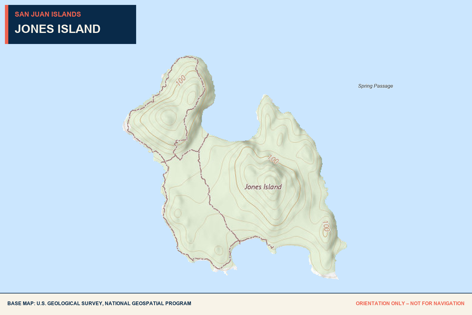
Jones Island Marine State Park is a 188-acre, boat-access-only park with approximately 25,000 feet of shoreline along San Juan Channel.
The park includes an ADA trail, a Cascadia Marine Trail campsite, 24 primitive campsites, and roughly four miles of hiking trails.
Camping
Twenty-four primitive campsites and pit toilets are available. Bring everything needed for the stay.
Water + provisions
There are no provisions on the island. Drinking water is reported available from May through September; confirm current availability before relying on it.
Pack it out
There is no trash service. Pack in all supplies and pack out all garbage.
Moorage fees
Fees are charged year-round from 1 p.m. to 8 a.m. Register on arrival; boats rafted to another boat at a park facility must also pay the applicable fee.
Pending
Local observations
needed.
No dated Baller Verified visit is currently on record. Share current moorage, dock, water, camping, or hazard observations to help complete this record.
Send updated local intel →Conditions, seasonal facilities, fees, and hazards can change. Confirm with current park notices and nautical charts.

Jones Island lending library

Mooring Balls on the south side of Jones island


Jones Island north cove at sunset