
Patos
Island
A remote northern marine park with two buoys in Active Cove, primitive camping, exposed conditions, and a working lighthouse near the Canadian border.
Active Cove.
Exposed conditions.
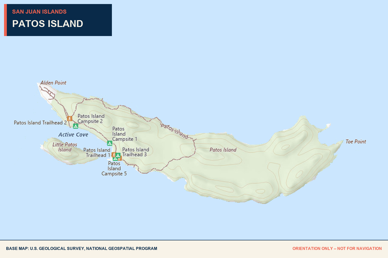
Active Cove is the island’s public boating and camping access point. Its narrow setting offers two state-park buoys but is affected by strong current and westerly weather from the Strait of Georgia.
2 year-round
Two mooring buoys are available first-come, first-served at Active Cove.
Phone-in
Phone registration is available at the buoys. Overnight fees apply from 1 p.m. to 8 a.m.
High caution
Strong current and westerly winds can cause boats to drag anchor and run aground.
12+ knot warning
Washington State Parks advises avoiding anchoring when high pressure or forecast winds greater than 12 knots affect the area.
48° 47′ 6″ N
122° 57′ 58.96″ W.
Active Cove beach
Beach access connects the moorage area with campsites, restrooms, and the lighthouse trail.
None
No fuel, pumpout, marine repair, or shopping services are available.
Check on arrival
Observe vessel and rafting limits posted on the buoys and at the shore bulletin board.
Primitive camping.
Remote shoreline.
Patos Island is a 207-acre, boat-access-only marine park with approximately 20,000 feet of shoreline. The Bureau of Land Management and Washington State Parks cooperatively manage the island.
Patos is the northernmost island in the San Juan archipelago and lies only a few miles from Canadian waters. Visitors must arrive fully self-sufficient.
Camping
Seven primitive campsites are available first-come, first-served. Campers register at the bulletin board near the beach.
Water + waste
There is no drinking water and no garbage service. Bring sufficient water and pack out everything brought ashore.
Facilities
Active Cove has one picnic site, one composting toilet, and one vault toilet.
Trail
A half-mile trail leads from the beach through madrone forest to the lighthouse at the island’s western end.
Working light.
Summer tours.
The lighthouse marks the island’s western end and the hazardous shoals offshore. The original light was established in 1893; the current structure dates to 1908.
Summer weekends
Tours are generally offered most weekends from Memorial Day through Labor Day, subject to weather and volunteer availability.
360-376-2073
Call Sucia Island State Park for current lighthouse-tour availability.
Scavenger-hunt stop
Look for the Coast Guard international-boundary marker near the lighthouse.
Station ruins
The route passes remnants of the former Coast Guard station and helicopter landing area.
Pending
Help us verify
Patos Island.
No dated Baller Verified visit is currently on record. Share recent observations about the buoys, current, anchoring conditions, camping facilities, lighthouse access, or changing restrictions.
Send local intel →Weather, current, moorage limits, fees, tours, facilities, and access can change. Confirm current park information and use current nautical charts before departure.