
Shaw
Island
A quiet ferry-served island with three useful anchoring areas, a historic waterfront store, mostly private shoreline, and four nearby state-park buoys at Blind Island.
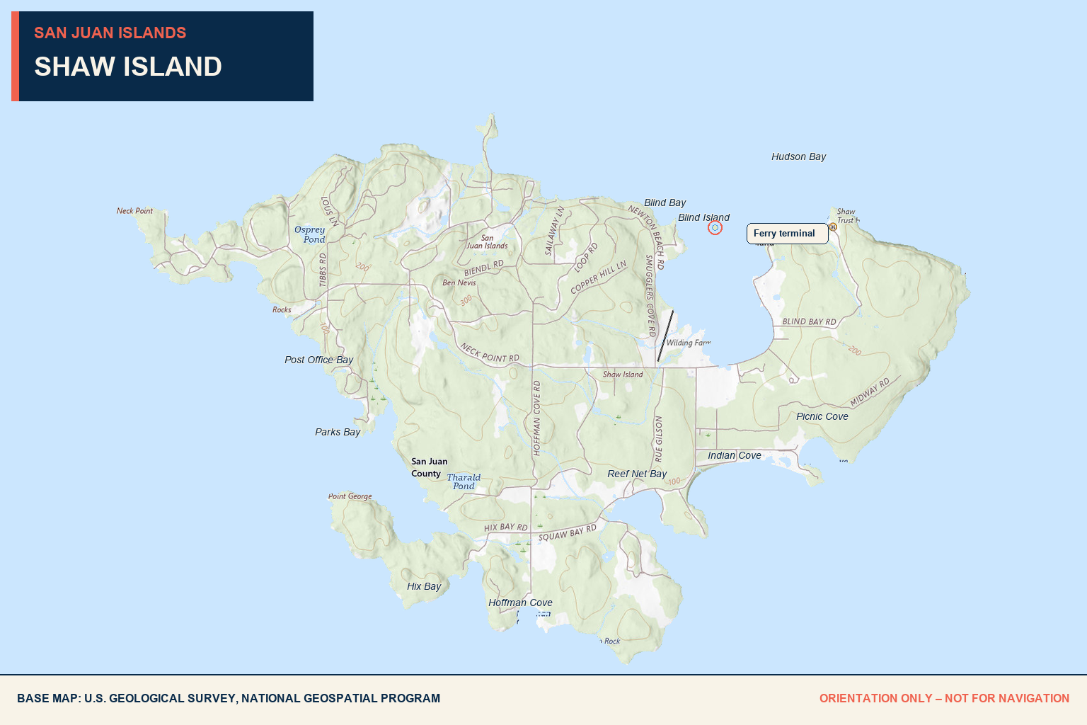
Blind Bay
Mud bottom
Blind Bay is a popular anchorage with generally useful holding in mud. Confirm depth, swing room, weather, and current conditions on arrival.
None
Shaw Island does not maintain public mooring buoys in Blind Bay.
4 at Blind Island
Four year-round Washington State Parks buoys lie south of nearby Blind Island. See the separate Blind Island guide for the complete details.
Mostly private
Blind Bay’s Shaw Island shoreline and tidelands are largely privately owned. Do not assume beach access.
Customer dock
The small private marina east of the ferry dock retains limited space for store customers. Call the store about larger boats; dinghies and small boats are generally accommodated.
General Store
Shaw General Store offers groceries, local produce, dairy, staples, small hardware, and the island post office. Confirm current hours.
Check current rules
Recreational crabbing can be productive. Check current seasons, licensing, catch reporting, and closures with WDFW.
None
No public fuel, pumpout, maintenance, potable-water, or full-service marina facilities are provided here.
Rocks.
Ferries.
Private shore.
Submerged rocks lie around Blind Island and within the approaches. Use current charts and enter only after assessing tide, depth, traffic, and visibility. Stay clear of ferry operations, never pass beneath the ferry ramp or bridge, and obtain permission before using the store’s private dock.
Parks Bay
Anchor only
Parks Bay is used as an anchorage. Assess bottom, depth, swing room, wind exposure, and current before setting.
None
No public mooring buoys are provided.
Private land
The surrounding shoreline is private. Remain aboard or in the navigable water unless you have explicit permission to land.
Special rules
Parks Bay is within the Shaw Island Marine Preserve. Bottomfish are closed, shellfish harvest is limited to crabbing, and other species-specific rules apply.
Allowed with limits
Confirm current seasons, licensing, reporting, gear, and preserve boundaries with WDFW.
None nearby
Bring required provisions or travel to the ferry landing and general store.
None
No marine fuel or pumpout service is available.
No public landing
This is not a shore-access destination. Plan it as an anchorage only.
Know the
preserve rules.
Do not generalize ordinary Marine Area rules to Parks Bay. Review the current Shaw Island Marine Preserve boundaries and species restrictions before placing fishing or crabbing gear.
Indian Cove
Useful anchorage
Indian Cove is another recognized Shaw Island anchoring area. Confirm holding, exposure, depth, and swing room locally.
None
No public mooring buoys are provided.
None
No public overnight dock space is listed for the cove.
Confirm before landing
Do not assume upland or tideland access. Use only clearly designated public access and respect private property.
None nearby
The island’s principal provisions are at Shaw General Store by the ferry landing.
None
Fuel is not available.
None
Pumpout service is not available.
None
No public maintenance or repair services are listed.
Confirm access.
Watch exposure.
Indian Cove may be useful in appropriate conditions, but it is not a full-service destination. Review current weather and charts, inspect holding on arrival, and treat nearby shoreline as private unless clearly marked otherwise.
Quiet roads.
A working island.
Shaw Island covers approximately 7.7 square miles and is served by Washington State Ferries. It is quieter and less commercially developed than the larger ferry-served islands.
Shaw rewards a slower visit: sheltered-water planning, walking quiet island roads, stopping at its historic store, and respecting the large amount of private shoreline.
Shaw General Store
Founded in 1898 and moved to its present waterfront location in 1924, the store remains the island’s commercial and social hub. Its adjacent warehouse began as a 1912 cannery.
Ferry connection
The ferry terminal serves the Anacortes and inter-island route. Small boats approaching the store marina must stay completely clear of ferry movements and structures.
Walking connections
Low traffic makes portions of Shaw pleasant to explore on foot, but roads remain active and most land is private. Walk cautiously and respect posted boundaries.
History
The island is within the ancestral territory of Coast Salish peoples, including the Lummi Nation. It was named for U.S. naval officer John Shaw during the Wilkes Expedition.
Aug 2023
Seals on the rocks.
A quiet shore stop.
We stayed near Shaw in August 2022 and August 2023. Harbor seals were frequently visible on the rocks, especially at low tide.
Provisions are available at Shaw General Store. Reaching its small customer dock requires care around the ferry terminal: stay clear of ferries, never pass beneath the ferry ramp, and let the store know when using the dinghy dock.
Shaw’s quiet roads are pleasant for stretching your legs. We also found the Shaw Island Gatehouse, where handcrafted seed packets were offered on the honor system.
Send updated local intel →This is a dated firsthand record. Buoy availability, ferry operations, store hours, dock access, fishing rules, fees, shoreline access, and boating conditions can change; confirm directly and use current nautical charts.

Along the entrance to Blind bay, this sign warns of rocks that can be missed at higher tides. Pat attention to your tide charts and maps to beware of hidden rocks.


Boat on a buoy at Blind Island
Fields seen on a walk - looking back toward Blind Bay from Shaw Island

We stumbled across this adorable little seed shop while out on a walk on Shaw Island. The Gate House has little handcrafted seed packets that were just devine. You can purchase with cash on an honor system.