
Spieden
Island
A privately owned, wildlife-filled island with no public moorage or shore access—but a memorable history and distinctive landscape for boaters cruising through Spieden Channel.
Private island.
No public landing.
Spieden Island is best treated as a cruise-by landmark. It is privately owned and does not provide public moorage, marina facilities, shore access, provisions, or visitor services.
None
No public mooring buoys are provided around the island.
None public
Structures visible on the island are private and are not visitor facilities.
None listed
No recommended public anchorage is included in this guide. Plan to continue to an established destination.
Private
Do not land, beach a dinghy, use docks, or enter upland areas without explicit authorization.
None
There are no public provisions, dining, shopping, or potable-water services.
None
Fuel is not available.
None
Pumpout service is not available.
None
No public maintenance, repair, or emergency marine services are based here.
Grassland south.
Forest north.
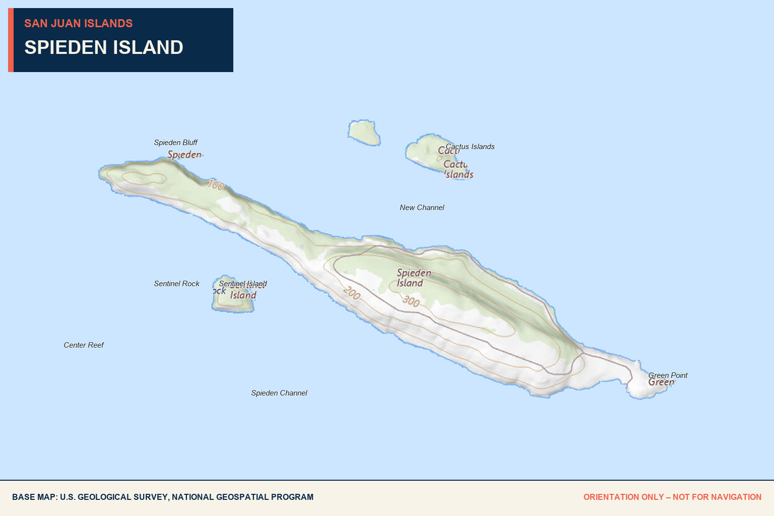
Spieden is approximately two miles long and about half a mile wide. Its contrasting slopes make it easy to recognize from the water.
The south-facing side is open, dry grassland scattered with glacial boulders. The north-facing side is greener and more heavily forested.
Boaters may see non-native deer and sheep grazing on the open slopes. Enjoy wildlife sightings from the vessel without approaching the shore or disturbing animals.
Wildlife viewing
Mouflon sheep, fallow deer, and sika deer introduced during the island’s private hunting-preserve era continue to inhabit the island.
Recognizable profile
Spieden Bluff marks the western end, while Green Point forms the eastern end. Sentinel Island and the Cactus Islands add useful visual context—but should not replace charted navigation.
No stop required
This page is designed as an orientation and history guide for boaters already transiting the area, not as an invitation to approach or land.
From expedition name
to “Safari Island.”
The island’s modern story combines nineteenth-century charting, private ownership, an unusual hunting venture, imported wildlife, and a later environmental-education period.
William Spieden
Charles Wilkes named the island during the 1838–1842 Wilkes Expedition for William Spieden, purser aboard the expedition vessel Peacock.
Hunting preserve
During the 1970s and 1980s, a private big-game hunting operation led to the nickname “Safari Island.”
Europe + Asia
Mouflon sheep, fallow deer, sika deer, and numerous exotic birds were brought to the island. Several ungulate populations remain visible today.
Lodge + airstrip
A hunting lodge, airstrip, hangar, roads, and other private structures were developed during and after this period.
Short-lived venture
The hunting operation ended amid environmental, ethical, and safety concerns, including concern about San Juan Island across the channel.
Island Institute
An environmental education program known as the Island Institute later operated on Spieden Island; it is no longer active.
Private
The island remains privately owned. Ownership does not create public shoreline or upland access.
Spieden Channel
The island sits less than a mile north of San Juan Island, between Haro Strait and President and San Juan channels.
Pending
Help us verify
Spieden Island.
No dated Baller Verified cruise-by observation is currently on record. Share recent notes about wildlife sightings, traffic, charted hazards, or changing conditions—without approaching or entering private property.
Send local intel →This page is for orientation and history only. Ownership, wildlife, structures, traffic, and water conditions can change. Use current nautical charts and maintain a respectful distance from private land.