
Satellite
Island
A private island nestled inside Prevost Harbor, best understood as part of the wider Stuart Island cruising area.
View Prevost Harbor moorage →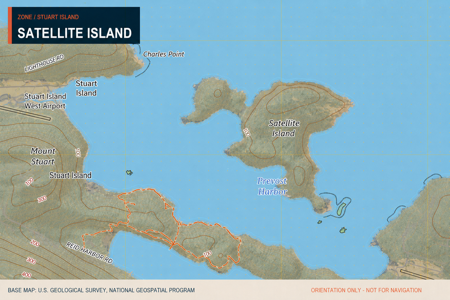
Plan around
Prevost Harbor.
The current Satellite Island guide does not list moorage on the island. Boaters should use the Stuart Island guide for current Prevost Harbor mooring and anchoring information.
None listed
No Satellite Island mooring buoys are listed on the current Salty Ballers page.
None public listed
The current page does not identify public dock space or a public landing.
Prevost Harbor
Refer to the Stuart Island guide and current official charts for nearby anchoring information.
None listed
Plan to arrive self-sufficient; no public shopping or supplies are listed for Satellite Island.
None nearby
No fuel is listed on Stuart Island. Plan fuel before entering the area.
Reid Harbor
The Stuart Island guide identifies the nearby pumpout facility in Reid Harbor.
None listed
No maintenance or repair services are listed for Satellite Island.
Private island
Do not assume public access. Confirm permission before landing or going ashore.
Operational information compiled from the existing Salty Ballers Satellite Island and Stuart Island pages · Review current official sources before departure.
Small island.
Distinct setting.
Satellite Island sits inside Prevost Harbor on the north side of Stuart Island, making it a recognizable part of the harbor landscape even though it is not a public moorage destination.
Satellite Island covers approximately 116.43 acres and has no permanent residents, according to the existing Salty Ballers guide.
The island is owned by the YMCA. Five campsites are described as being maintained for YMCA use, primarily for campers associated with Camp Orkila on Orcas Island. These are not presented as public campsites.
Relationship to Stuart Island
The island is nestled within Prevost Harbor, immediately beside northern Stuart Island. Nearby public boating facilities and shore destinations are covered on the Stuart Island page.
Camping
The existing guide identifies five YMCA campsites used mostly by Camp Orkila campers. Confirm authorization directly with the owner; do not treat these as public marine campsites.
Shore connections
No public shore connection is listed. Use the public landings and walking routes described for Stuart Island rather than planning to land on Satellite Island.
A name from
the survey era.
Satellite Island was named for HMS Satellite, a British naval vessel captained by James Charles Prevost. The existing guide notes that the ship was stationed at Vancouver Island from 1857 to 1860.
Pending
Help us verify
Satellite Island.
We do not yet have a dated Baller Verified visit record for Satellite Island. If you have recently observed access conditions, private-use markers, nearby anchoring conditions, or other useful changes, share your local information with the Salty Ballers crew.
Send local intel →Baller Verified reflects dated firsthand experience. Conditions change; always rely on current official information for navigation and trip decisions.